If you’re considering a drone survey in London, understanding how it works — and who to hire — is key to getting accurate, affordable results.
What is a Drone Survey?
Overview of drone surveying technology Types of data collected (photogrammetry, LiDAR, thermal) Common uses in urban areas like London
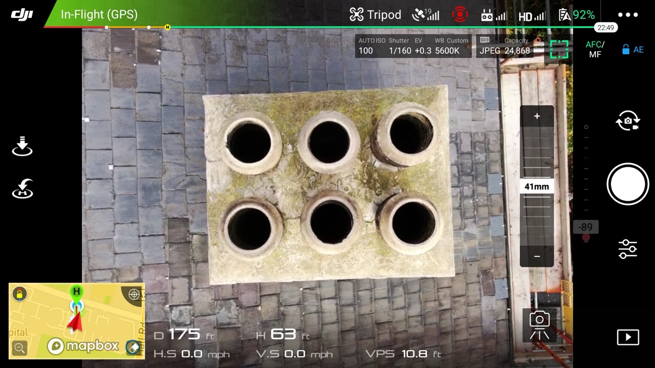
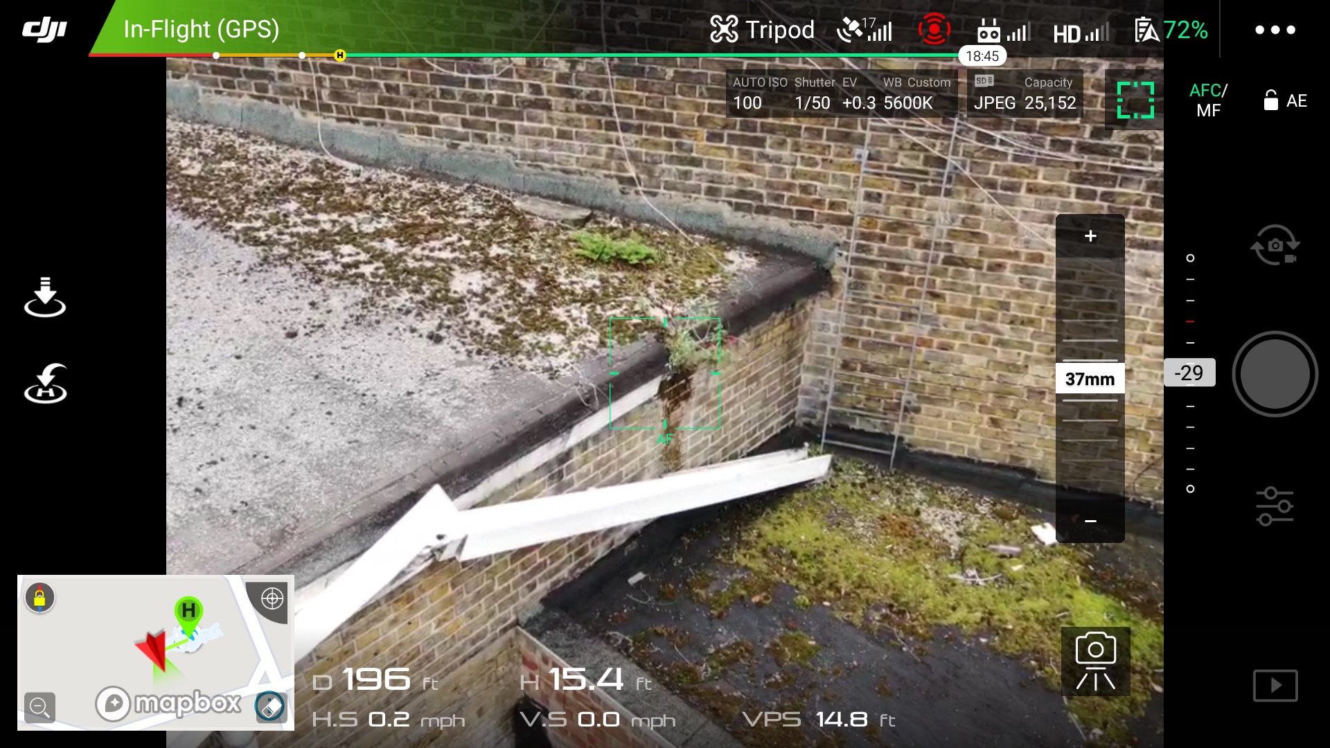
view from the drone
Why Choose a Drone Survey in London?
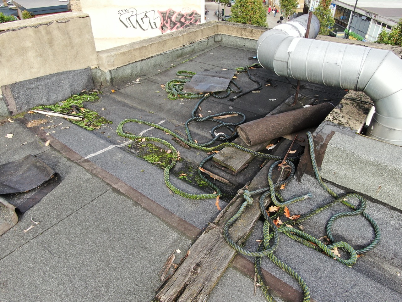
Quick deployment in tight urban spaces Non-invasive (ideal for roof inspections) Reduced risk (no scaffolding or manual inspections) High-resolution data & 3D mapping
In a densely populated city like London, drones offer a safer and faster alternative to traditional survey methods.
Key Regulations for Drone Surveys in London
CAA (Civil Aviation Authority) permissions Flight restrictions (e.g., near airports, over crowds) Importance of hiring an operator with a valid Operational Authorisation (formerly PfCO)
What to Look for When Hiring a Drone Survey Provider in London
Certification and insurance Experience with local regulations Portfolio of similar projects (bonus if in London boroughs) Equipment used (e.g., RTK drones, thermal sensors)
Typical Costs for a Drone Survey in London
Average price range (depending on project size and data type) How complexity and airspace can affect cost Cost comparison to traditional surveying methods
Questions to Ask Before Hiring
Do you have CAA approval to fly in Central London? What kind of deliverables will I receive (photos, maps, 3D models)? How long will the survey take for any drone survey company London Can you help with planning applications or BIM integrations?
Real-World Examples:
If you’re looking for further advice or help with any aspect of drone surveying or data capture in London or any other part of the UK please get in touch. We can help you with the safest and most cost effective methods of capturing your site. Safe, easy and low cost compared to other traditional surveying methods. Please drop us a line here at HeliDrone Surveys